Augusta Wisconsin map including the Augusta Wisconsin Recreation Area
The Augusta Wisconsin Recreation Area, a photo from Space All locations are less than 10 miles from Augusta Wisconsin
The area is intertwined with private property, please respect all No Trespassing and No Hunting signs.
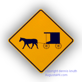
Amish Buggies and modern automobiles share our country roads. Please drive especially carefully when mounting hills and rounding corners on our country roads, there may be an Amish buggy just out of site

Augusta Wisconsin From Space including the location of Coon Fork and Harstad Campgrounds, Parks, Points of Interest, Bridge over Troubled Waters and the said to be haunted Green Eyes Bridge (aka Bridge Over Troubled Waters, or Bridge Over Trouble Waters)
Recreation in Augusta Wisconsin Wildlife Area is great for fishing on the Dells Pond, The Eau Claire River, Lake Eau Claire Bridgecreek and other creeks in the area. You can catch Trout, Carp, Sunfish, Crappies, Perch, Blue Gills, Bass, Walleyes, Walleyed Pike. Find the Troubled Waters area, the Dells Mill Pond and Museum, Coon Fork Campgrounds
The Satellite Map of the Augusta Wisconsin
Recreation Area in the Town of Bridge Creek in Eau Claire County
Come visit Augusta Wisconsin - We would love to have you enjoy our every day space, hunt, fish, and camp.